An early warning system to improve adaptive capabilities and resilience of vulnerable Himalayan communities to extreme rainfall and flooding, 2021 to 2022
- 3vulnerable habitations
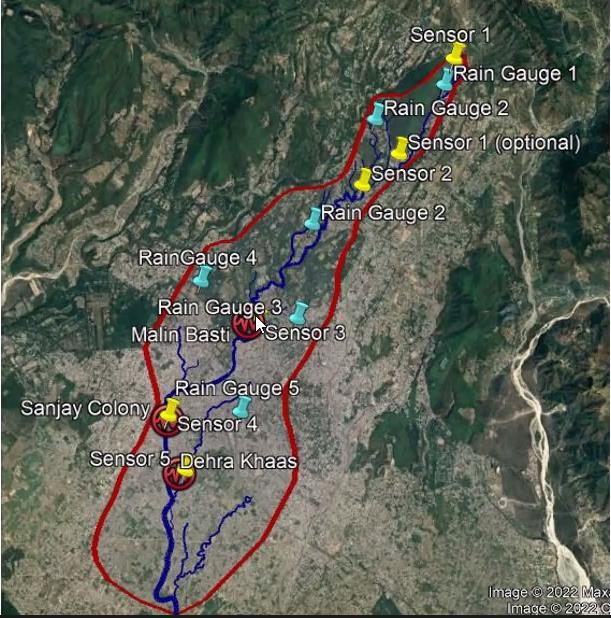
- 3water-level sensors and rain gauges
The Project aimed to strengthen flood resilience among vulnerable communities living on the banks of Bindal Rao river. It was supported by the University of Birmingham, UK.
The study assessed historical flood impacts, existing risk management practices and information needs through record reviews and interviews. Through semi structured interviews with the community and civil society members, the research draws on the community perception and priorities.
The findings led the team to identify three vulnerable habitations along the riverbank. The three water- level sensors and rain gauges were installed at these sites.
In addition to this, a colour coded dashboard was co created to communicate flood risks and knowledge sharing. The District Disaster Management Authority volunteered to monitor the dashboard and share alerts with communities to help them to prepare for timely flood response.